Escaped youth tracked by Eagle helicopter, found hiding in New Brighton
The young person who escaped from a youth justice facility in Rolleston has been located...
Proudly powered by VAST – NZ’s leading digital advertising billboard company. FIND OUT MORE

The young person who escaped from a youth justice facility in Rolleston has been located...

A person has been seriously injured on State Highway 75, Christchurch Akaroa Road. A police...

BodyFix Gym Christchurch in Phillipstown has taken out two major honours at the Exercise New...

Local MPs have found areas of agreement on major Resource Management Act reforms, during a...

A series of public events have been organised across Christchurch and Lyttelton over the coming...

A woman was taken to hospital after a ‘water incident’ at Parakiore Recreation and Sport...
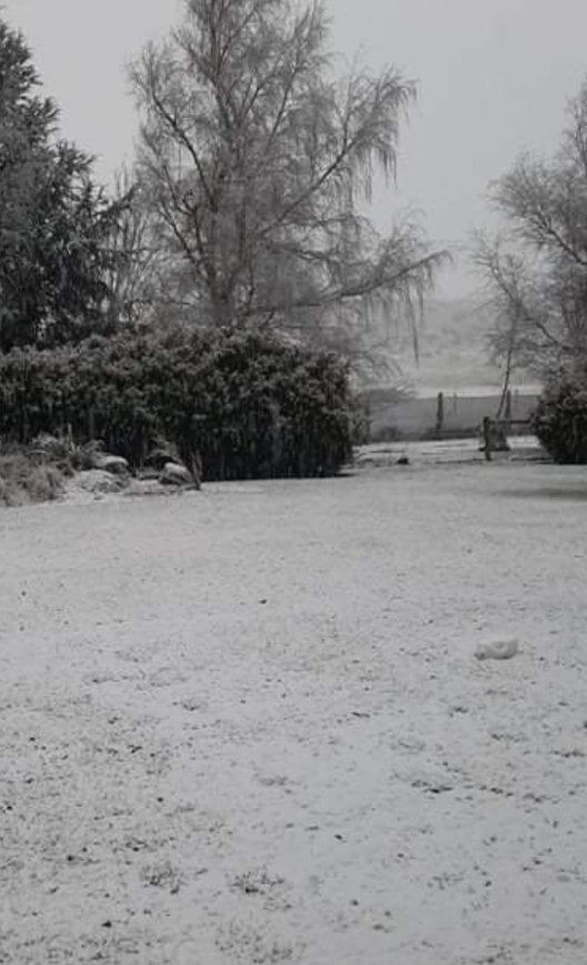
Metservice has issued new snow warnings.
It says snow is possible down to sea level in the Marlborough area south of Seddon and Canterbury north of the Rakaia river.
It is expected to become heavy inland above about 200 metres where 15 to 30 cm of snow is forecast to accumulate, or possibly more at higher levels.
Snow showers are likely to sea level Sunday night and Monday morning, these may affect Christchurch and Banks Peninsula.
Metservice said heavy snow may disrupt travel in affected areas and could damage trees and powerlines. Cold conditions may cause stress for livestock.
LEWIS PASS (SH7)
Heavy snow is expected to develop on Sunday morning, before easing in the evening. Expect 20 to 25 cm of snow to accumulate on the road, especially east of the summit.
AREA: ARTHUR’S PASS (SH73)
Heavy snow is expected to develop on Sunday morning, before easing in the evening. Expect 15 to 25 cm of snow to accumulate on the road.
PORTERS PASS (SH73)
Heavy snow is expected to develop on Sunday morning, before easing in the evening. Expect 20 to 30 cm of snow to accumulate on the road.
HAAST PASS (SH6)
Snow showers could possibly affect the road overnight tonight and early Sunday morning when 1 to 2 cm of snow may settle on the road above 500 metres.
LINDIS PASS (SH8)
A few snow showers may affect the road tonight and during Sunday, where 1 to 2 cm may briefly accumulate on the road above 300 metres at times.
Snow in Mt Somers, Mid Canterbury. Only been falling for 20 mins says Tania King.