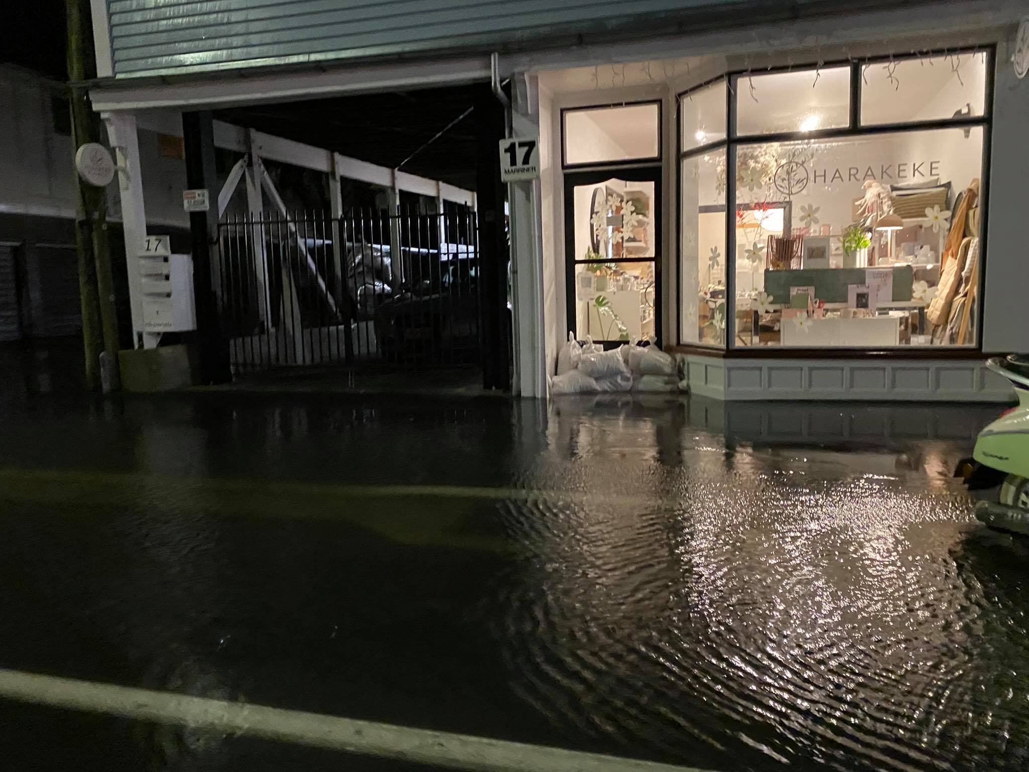
Retailers across Christchurch are bracing themselves for flooding using sand bags outside their shops.
Surface flooding is already affecting parts of Sumner village.
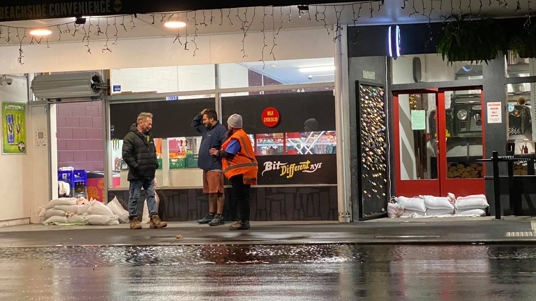
Sumner Village retailers preparing for flood waters Photo: Chris Lynch Media
Christchurch City Council contractors are preparing to help ease flooding.
City Care Water trucks have been deployed to flood prone areas.
A resident on Mackenzie Avenue in Woolston told Chris Lynch the nearby stream has flooded onto the road.
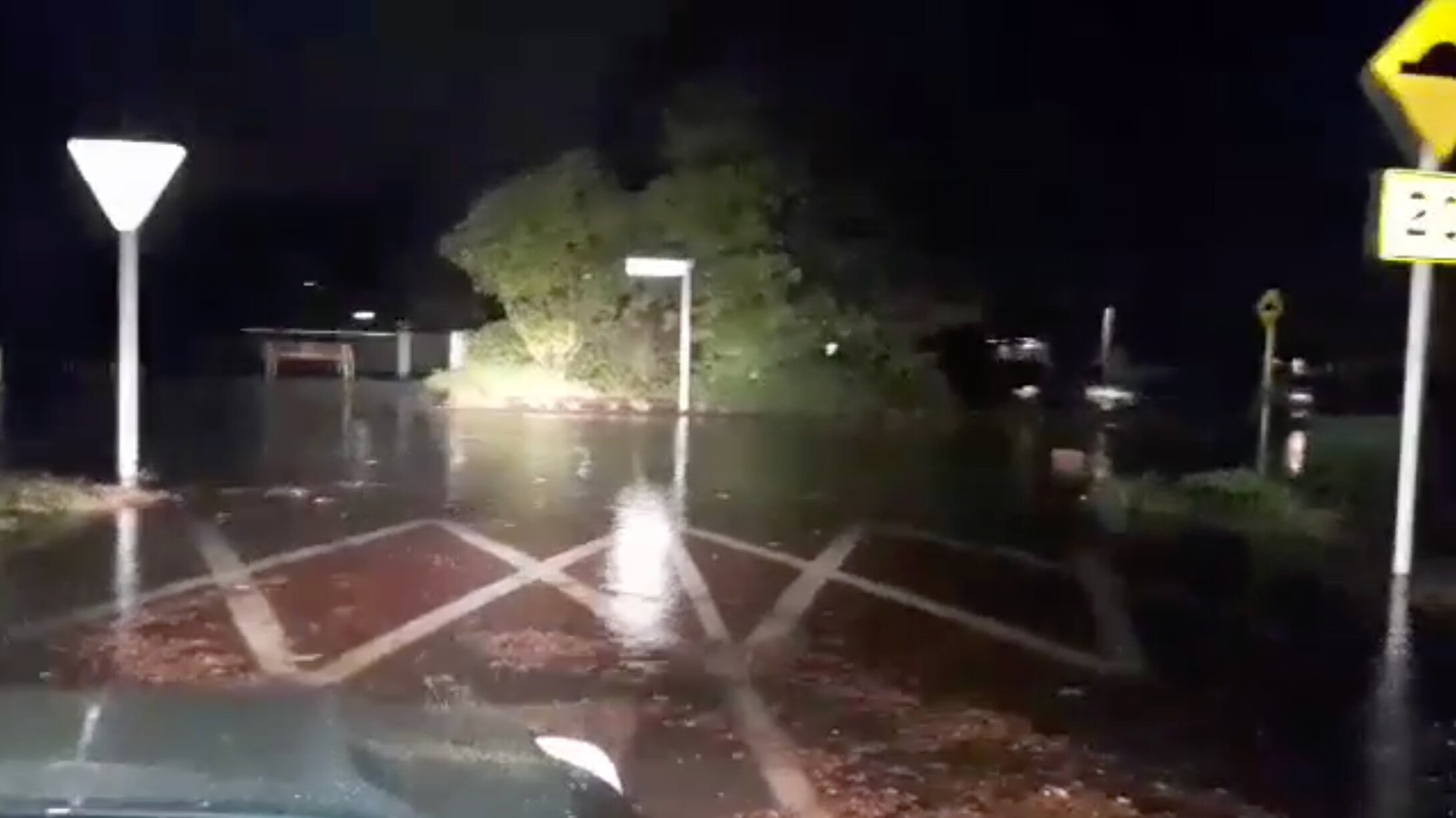
Mackenzie Avenue in Woolston / Supplied
Metservice has updated its forecast tonight and severe heavy rainfall is still on the cards for Canterbury.
A Police spokeswoman told Chris Lynch emergency crews are attending 3 – 4 flood related incidents in Christchurch, but other agencies are managing them – predominantly the Christchurch City Council and Fire and Emergency New Zealand.
Police were not involved in the evacuation of any houses at this stage.
She said should the situation escalate and a large number of houses need evacuating, police may assist but Civil Defence would be the lead agency.
Sumner Village retailers preparing for flood waters Photo: Chris Lynch Media
Blue Skies Weather’s Tony Trewinnard said when it comes to latest computer guidance not much changed from 12 hours earlier, forecasting a rainfall range of 55-125mm with a mean of 80mm and the control run a 95mm (for Christchurch by Monday night).
“However, some other guidance has increased to 95-100mm for the city for the first time in many days of predictions. Almost all of the Canterbury region is showing event totals of 125mm+ apart from the rain shadow area around Banks Peninsula (including the city). Substantial areas inland are 250mm plus.”
“Also worth noting that the strong to near gale easterly winds are due to peak into Pegasus Bay 3-5am tomorrow morning are now modelled to be stronger than was indicated this morning. This may induce unheralded complexities to the weather patterns in Mid Canterbury tomorrow.”
Red Warning still in place
A Red Warning for Heavy Rain is in force for the region south of Amberley, and an Orange Warning for Heavy Rain is in force for the region from Amberley to Kaikoura.
Dangerous river conditions and flooding are expected. Slips and floodwaters are likely to disrupt travel, making some roads impassable and possibly isolating communities.
People are advised to keep up to date with the latest forecasts and any advice from local authorities.
Heavy Rain Warning for Canterbury
Metservice said rain is expected to cause dangerous river conditions and significant flooding. Slips and floodwaters are likely to disrupt travel, making some roads impassable and possibly isolating communities.
Canterbury south of Amberley
In addition to rain which has already accumulated, expect 200 to 300mm of rain about the Canterbury High Country and foothills, with 100 to 140mm of rain farther east about the Plains and coast. Peak hourly rates of 10 to 20mm/h are expected. Note, that some of this precipitation may fall as snow above about 900 metres.
Canterbury north of Amberley, and Marlborough about and south of Kaikoura
Valid: 42 hours from 9:00pm Saturday to 3:00pm Monday
Forecast: Expect 150 to 200mm of rain. Peak rates of reaching 10 to 20mm/h at times.