As the Port Hills fire continues to burn, MetService is forecasting warm temperatures and winds to stay strong today (Thursday) and ease at night.
Winds are expected to remain benign over much of the country for the weekend, before northwesterlies whip up again by the end of Sunday into the new week.
Meanwhile, temperatures in the east of the North and South Island are expected to respond to westerly winds over the coming days.
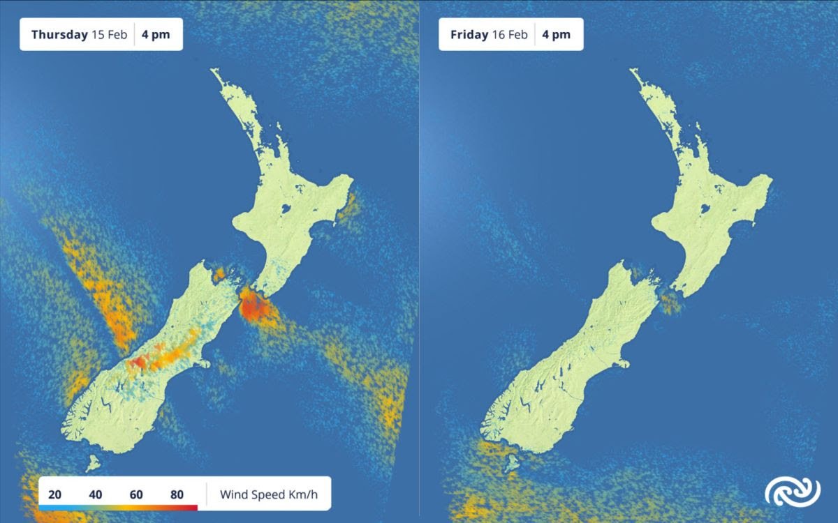
Strong winds in Christchurch and the Port Hills region reached 50 to 55 km/h on Wednesday afternoon and evening, before easing overnight.
As a front moves up the South Island today, northwesterly winds are expected to pick up again in the afternoon over Canterbury.
MetService meteorologist Mmathapelo Makgabutlane said “strong winds this afternoon will not be good news for those battling the fires in Canterbury.
“We will be keeping a close eye on the front as it approaches as it is expected to bring a drop in the winds from late tonight as it passes.
“It will also bring a change in wind direction, which could see smoke potentially spreading across the city tomorrow. It may even bring a possible shower, though this will not be enough to douse the flames.”
Friday and the weekend bring relief from the winds for the South Island.
By the end of the weekend and into Monday, however, winds pick up ahead of a new approaching front from the Tasman Sea.
“Places like Southland, Clutha, and inland Canterbury could have quite a windy start to the new week. It will be well worth keeping an eye on the MetService website for any possible Watches or Warnings for Strong Winds,” Makgabutlane advised.
The western South Island sees the opposite effects from that front, where heavy rain is expected. The ranges of Westland and Grey are under an Orange Warning for Heavy Rain until Friday morning, while Buller south of Hector is under Watch from tonight until Friday afternoon.
The general westerly wind regime over the next few days means the eastern parts of the North and South Island can expect warm temperatures at times.
“Today is another warm day for Canterbury, before the front causes things to switch back to average on Friday and Saturday.
“Sunday and Monday see a return to temperatures in the upper twenties once again.
“For the eastern North Island, things look to remain steadily warm from today well into next week. On Monday, parts of Hawke’s Bay could be touching 30°C.”
With these warm and windy conditions, Makgabutlane offers a reminder about fire weather safety: “It’s been a dry summer for many of us.
“With more warm and windy weather on the way, it’s always good to remember to check local fire danger conditions on Check It’s Alright. If you haven’t already, it would be worth enabling push notifications on the MetService App to be notified when fire danger conditions in your area are ‘Extreme’.”